Comprehensive Low-Altitude Radar Detection Systems: Advanced Technology for Modern Airspace Security
Meta Description: Discover cutting-edge low-altitude radar detection systems with comprehensive technical specifications, applications, and deployment strategies. Learn about KU-band radar technology, multi-sensor integration, and counter-drone capabilities for critical infrastructure protection.
Introduction
In an era where unmanned aerial systems (UAS) proliferate across civilian and military domains, the imperative for sophisticated low-altitude radar detection systems has reached unprecedented levels. The evolution of airspace security demands not merely reactive measures, but proactive, integrated solutions that amalgamate multiple detection modalities into cohesive operational frameworks.
Contemporary low-altitude radar systems, exemplified by advanced platforms such as the TYZF-211 integrated detection and countermeasure system, represent a paradigm shift from traditional air defense architectures. These systems orchestrate a symphony of technologies—encompassing electromagnetic spectrum analysis, precision radar tracking, electro-optical surveillance, and electronic warfare capabilities—to create an impenetrable shield against unauthorized aerial intrusions.
The technical sophistication embedded within modern low-altitude radar systems extends far beyond simple detection mechanisms. By leveraging KU-band frequency operations, these platforms achieve remarkable resolution capabilities while maintaining operational effectiveness across diverse environmental conditions. This technological convergence addresses the fundamental challenge of modern airspace management: the ability to detect, track, identify, and neutralize threats ranging from consumer-grade quadcopters to sophisticated military-grade reconnaissance drones.
Comprehensive Technical Specifications
The architectural framework of advanced low-altitude radar systems encompasses multiple integrated subsystems, each optimized for specific operational parameters:
Primary Detection Systems Comparison
| System Component | TYZF-211 Advanced Platform | Industry Standard | Performance Advantage |
|---|---|---|---|
| Radio Frequency Detection | 200MHz-6000MHz | 400MHz-2400MHz | 150% broader spectrum coverage |
| Detection Range | ≥8km (radio), ≥5km (radar) | 3-5km typical | 60-160% enhanced range |
| Radar Frequency Band | KU-band (12-18 GHz) | X-band (8-12 GHz) | Superior resolution and weather penetration |
| Angular Accuracy | ≤0.3° (azimuth/elevation) | ≤0.5-1.0° | 40-70% improved precision |
| Range Resolution | ≤6m | ≤10-15m | 40-60% finer granularity |
| Optical Detection Range | ≥2.5km (visible spectrum) | 1.5-2km | 25-67% extended visibility |
| Operating Temperature | -20°C to +60°C | -10°C to +50°C | Extreme environment capability |
Multi-Sensor Integration Architecture
The system’s effectiveness derives from sophisticated sensor fusion algorithms that correlate data streams from disparate detection modalities:
- Electromagnetic Spectrum Analysis: Continuous monitoring across 200MHz-6000MHz enables detection of control signals, telemetry data, and video transmission frequencies utilized by various drone platforms.
- Active Radar Surveillance: KU-band radar operations provide high-resolution tracking with range accuracy within 6 meters and angular precision exceeding 0.3 degrees.
- Passive Electro-Optical Tracking: Complementary visual spectrum cameras deliver target identification and classification capabilities, essential for distinguishing between authorized and unauthorized aerial vehicles.
- Electronic Countermeasures: Integrated jamming systems capable of disrupting drone communications across the entire operational frequency spectrum.
Advanced Applications and Deployment Scenarios
The versatility of modern low-altitude radar systems enables deployment across diverse operational contexts:
Critical Infrastructure Protection
| Infrastructure Type | Threat Vectors | Radar Configuration | Countermeasure Strategy |
|---|---|---|---|
| Airports | Runway incursions, navigation interference | Multi-layered coverage with 10km radius | Graduated response: detection→warning→jamming |
| Power Plants | Surveillance, physical attack | Perimeter-focused with vertical coverage | Immediate neutralization protocols |
| Government Facilities | Intelligence gathering, security breaches | High-density urban deployment | Selective frequency disruption |
| Military Installations | Reconnaissance, targeting | Extended range with mobile units | Kinetic and non-kinetic options |
| Public Events | Crowd monitoring, potential attacks | Temporary deployments with rapid setup | Proportional response framework |
Technical Implementation Examples
Case Study 1: Urban Deployment Configuration In metropolitan environments, radar systems must contend with significant electromagnetic interference and physical obstructions. The KU-band frequency selection provides superior building penetration compared to lower frequency alternatives, while advanced signal processing algorithms filter urban clutter to maintain detection probability above 95% for targets as small as 0.01m² radar cross-section.
Case Study 2: Maritime Border Security Coastal installations leverage the radar’s weather-resistant design (-20°C to +60°C operational range) to maintain continuous surveillance despite salt spray, high humidity, and temperature extremes. The system’s 5km+ detection range enables early warning of maritime-launched drones attempting coastal infiltration.
Radar Characteristics and Performance Metrics
Signal Processing Architecture
The fundamental advantage of KU-band operation lies in its optimal balance between atmospheric attenuation and target resolution. Operating within the 12-18 GHz spectrum, these systems achieve:
- Doppler Resolution: Capable of distinguishing relative velocities as small as 0.1 m/s
- Minimum Detectable Signal: -90 dBm sensitivity enables detection of low-observable targets
- Probability of Detection: >98% for DJI Phantom-class targets at 3km range
- False Alarm Rate: <10^-6 per scan through advanced CFAR (Constant False Alarm Rate) processing
Environmental Adaptation Mechanisms
The system employs sophisticated environmental compensation algorithms:
| Environmental Factor | Impact on Performance | Compensation Method | Residual Effect |
|---|---|---|---|
| Rain (25mm/hr) | 3dB/km attenuation at KU-band | Automatic gain adjustment | <5% range reduction |
| Fog (visibility <100m) | Minimal RF impact | Electro-optical augmentation | Radar primary mode |
| Wind (>50km/h) | Target trajectory variance | Kalman filter prediction | Maintained track accuracy |
| Temperature extremes | Component drift | Real-time calibration | <0.1° angular error |
Regulatory Compliance and Certification
International Standards Adherence
| Regulatory Framework | Compliance Status | Certification Details |
|---|---|---|
| FCC Part 15 | Fully compliant | Emissions below -50dBm/MHz EIRP |
| CE EN 301 489 | Certified | Electromagnetic compatibility verified |
| MIL-STD-461G | Meets requirements | Military electromagnetic interference standards |
| IEC 60950-1 | Safety certified | Electrical safety for operators |
| IP66 Rating | Environmental sealed | Dust-tight and water-resistant |
Frequency Coordination Requirements
Operating within regulated spectrum requires careful coordination with aviation authorities and telecommunications regulators. The system implements:
- Automatic frequency agility to avoid interference
- Geo-fencing capabilities to restrict emissions near sensitive installations
- Time-division operation modes for spectrum sharing
- Real-time spectrum monitoring and adaptive transmission
Comprehensive Packaging and Deployment
Mobile Platform Integration
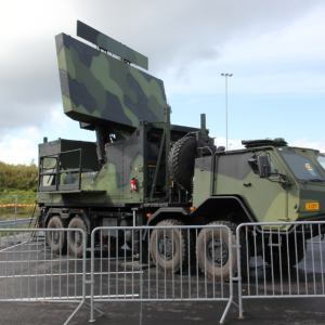
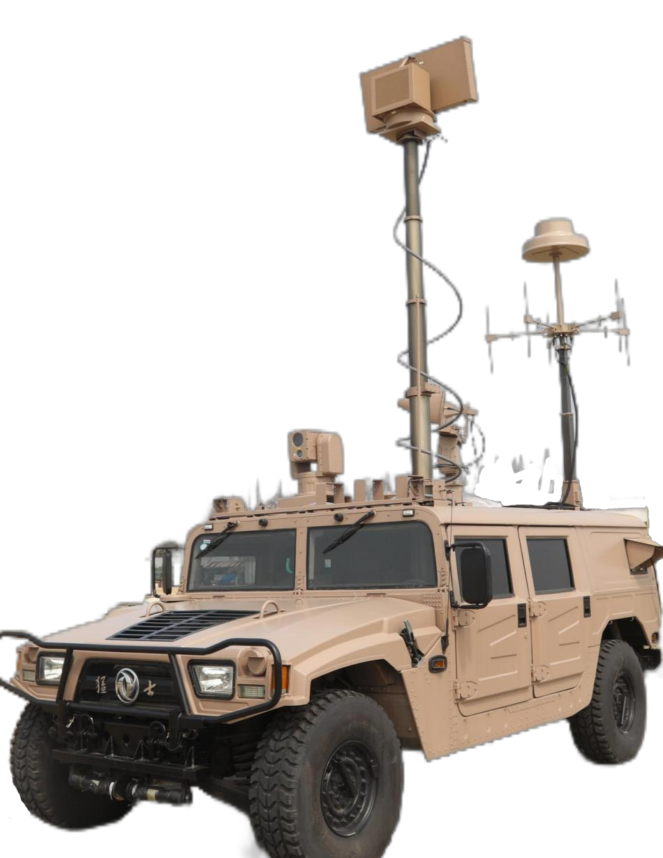
The TYZF-211 system’s vehicle-mounted configuration offers strategic advantages:
Standard Configuration Package:
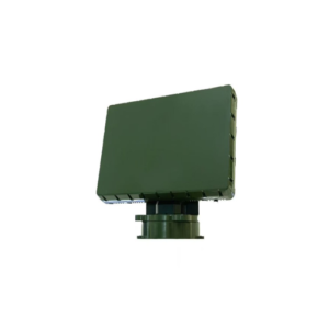
- Primary radar unit with stabilized mounting platform
- Integrated command and control station
- Redundant power generation systems (24/48V DC, 220V AC)
- Environmental control unit for equipment bay
- Rapid deployment kit (<30 minutes setup time)
Optional Enhancement Modules:
- Extended range antenna arrays (+50% detection distance)
- Supplementary electro-optical turrets
- Satellite communication uplink
- Remote operation capability (up to 10km fiber optic link)
Detailed User Guide and Operational Procedures
System Initialization Protocol
- Pre-Deployment Checklist
- Verify vehicle stabilization on level ground (±2° maximum inclination)
- Confirm minimum 50m clearance from large metallic structures
- Validate GPS lock for position reference (minimum 6 satellites)
- Execute built-in test (BIT) sequence
- Operational Mode Selection
| Mode | Application | Power Consumption | Detection Priority |
|---|---|---|---|
| Surveillance | Continuous monitoring | 2.5kW average | Maximum range |
| Tracking | Active target engagement | 4.0kW average | Precision tracking |
| Standby | Alert status | 0.5kW average | Rapid activation |
| Training | Operator qualification | 2.0kW average | Simulated targets |
Advanced Operation Techniques
Multi-Target Tracking Optimization: The system can simultaneously track up to 200 targets using advanced plot-to-track association algorithms. Operators should prioritize threats based on:
- Proximity to protected assets
- Velocity vectors indicating hostile intent
- Signal characteristics suggesting payload capacity
- Behavioral anomalies from normal flight patterns
Maintenance Requirements and Lifecycle Management
Preventive Maintenance Schedule
| Interval | Maintenance Activity | Duration | Skill Level Required |
|---|---|---|---|
| Daily | Visual inspection, BIT execution | 30 minutes | Operator |
| Weekly | Antenna cleaning, cable inspection | 2 hours | Technician |
| Monthly | Calibration verification, software updates | 4 hours | Engineer |
| Quarterly | Component testing, bearing lubrication | 8 hours | Specialist |
| Annually | Major overhaul, component replacement | 24 hours | Factory team |
Performance Degradation Indicators
Monitor these parameters to ensure optimal system performance:
- Receiver noise figure increase >1dB
- Transmitter power reduction >10%
- Angular accuracy degradation >0.1°
- False alarm rate increase >2x baseline
Critical Radar Application Scenarios
Scenario 1: Mass Event Security
During large public gatherings, the radar system operates in a high-sensitivity mode, creating multiple detection zones:
Inner Perimeter (0-1km): Immediate threat zone with automatic countermeasure activation Middle Zone (1-3km): Enhanced tracking with operator notification Outer Zone (3-5km): Early warning and classification sector
Scenario 2: Critical Infrastructure Defense
Power generation facilities require 24/7 protection against both surveillance and kinetic threats:
Layered Defense Architecture:
- Primary radar coverage at 5km radius
- Secondary electro-optical verification at 2.5km
- Electronic countermeasures activation at 1km
- Physical interception readiness at 500m
Scenario 3: Border Security Operations
Extended linear coverage along national boundaries demands distributed sensor networks:
Network Topology:
- Master nodes every 10km with full capability
- Slave nodes at 5km intervals for gap coverage
- Centralized command center with data fusion
- Mobile rapid response units for threat prosecution
Conclusions and Future Perspectives
The evolution of low-altitude radar detection systems represents a critical technological response to emerging aerial threats. The integration of multiple sensor modalities, sophisticated signal processing algorithms, and adaptive countermeasure capabilities creates a robust defensive framework suitable for diverse operational requirements.
As drone technology continues to advance, incorporating artificial intelligence, swarm behaviors, and reduced signatures, radar systems must correspondingly evolve. Future developments will likely emphasize:
- Machine learning for behavioral analysis and threat prediction
- Quantum radar technologies for enhanced low-observable detection
- Directed energy systems for hard-kill capabilities
- Autonomous response frameworks reducing operator workload
The TYZF-211 and similar advanced platforms establish a new baseline for airspace security, demonstrating that effective counter-UAS operations require not merely superior technology, but intelligent integration of complementary capabilities within adaptable operational frameworks.
Frequently Asked Questions
Q1: What distinguishes KU-band radar from X-band or S-band alternatives for drone detection?
KU-band radar (12-18 GHz) offers superior resolution due to shorter wavelengths, enabling detection of smaller targets and better discrimination in cluttered environments. While atmospheric attenuation is higher than lower frequency bands, the 5km operational range remains well within effective limits. The higher frequency also allows for more compact antenna designs, crucial for mobile deployments.
Q2: How does the system differentiate between authorized drones and potential threats?
The system employs a multi-layered identification process: First, RF signature analysis identifies drone model and communication protocols. Second, flight behavior analysis compares trajectories against authorized flight plans. Third, the integrated IFF (Identification Friend or Foe) subsystem can query cooperative targets. Finally, electro-optical systems provide visual confirmation for operator classification.
Q3: Can the radar system operate effectively in severe weather conditions?
Yes, the system maintains operational capability from -20°C to +60°C with full environmental sealing (IP66 rating). During heavy precipitation, automatic gain compensation maintains detection performance with less than 15% range degradation in extreme conditions (50mm/hr rainfall). The KU-band selection provides better weather penetration than higher frequency alternatives like Ka-band.
Q4: What countermeasures can sophisticated drones employ against radar detection?
Advanced drones might utilize radar-absorbing materials, terrain masking, or spoofing techniques. However, the multi-spectral approach (RF + radar + electro-optical) ensures detection even when individual sensors are compromised. The system’s 200MHz-6000MHz RF detection range captures control signals that cannot be eliminated without losing drone functionality.
Q5: How many operators are required for full system operation?
Minimum operational capability requires one trained operator who can monitor all subsystems through the integrated command console. Optimal configuration employs two operators: one for radar/RF systems and another for electro-optical tracking and countermeasure deployment. The system’s automation reduces workload through intelligent threat prioritization and response recommendations.
Q6: What is the typical engagement sequence upon detecting an unauthorized drone?
The graduated response protocol follows: (1) Detection and classification within 10 seconds, (2) Operator alert with threat assessment, (3) Attempt RF identification and warning transmission, (4) Initiate tracking and recording for evidence, (5) Deploy proportional countermeasures starting with communication jamming, (6) Escalate to navigation spoofing if necessary, (7) Coordinate with security forces for physical interception if required.
Q7: How does navigation spoofing differ from simple jamming?
While jamming disrupts GPS signals causing most drones to hover or return home, navigation spoofing transmits false GPS coordinates, actively redirecting the drone to a designated safe area. This technique is particularly effective against autonomous drones programmed to continue missions despite communication loss. The system can simultaneously spoof GPS L1 and GLONASS L1 frequencies.
Q8: What are the power requirements for continuous operation?
The complete system requires approximately 5kW peak power during full operational mode. The vehicle-mounted platform includes redundant power generation: primary 10kW diesel generator, secondary battery bank providing 4 hours emergency operation, and auxiliary connection for external power. Intelligent power management reduces consumption to 2.5kW during routine surveillance.
Q9: Can the radar system integrate with existing air traffic control infrastructure?
Yes, the system includes standard ASTERIX CAT-240 data output for integration with civilian ATC systems and Link-16 compatibility for military networks. Real-time track data can be shared with command centers via encrypted IP networks, enabling coordinated response across multiple agencies. The open architecture supports custom integration protocols.
Q10: What training is required for system operators?
Basic operator certification requires 40 hours of instruction covering: system theory (8 hours), hands-on operation (16 hours), threat recognition (8 hours), and emergency procedures (8 hours). Advanced operator training adds 24 hours focusing on system maintenance, tactical employment, and multi-unit coordination. Recertification is required annually with 8 hours of refresher training.
Q11: How does the system handle multiple simultaneous drone intrusions?
The advanced signal processing capability supports tracking up to 200 simultaneous targets with automatic threat prioritization based on proximity, velocity, and behavior patterns. The system allocates resources dynamically, focusing high-precision tracking on the highest priority threats while maintaining surveillance on all detected objects. Operators receive intelligent recommendations for countermeasure deployment against multiple targets.
Q12: What is the expected operational lifespan and upgrade path?
With proper maintenance, the core system demonstrates a 10-year operational life with >95% availability. Modular architecture enables incremental upgrades: software updates every 6 months incorporate new threat signatures, hardware refresh at 5 years maintains technological currency, and major capability upgrades can extend operational relevance beyond 15 years. The platform’s open architecture ensures compatibility with emerging technologies.